
|
What can I say about the month of June?, well not a lot really. According to my own log books and records June 2022 has been the most uneventful I have ever experienced in over 25 years of sky watching, and it has all been down to the weather. Normally when you think of a bad Summer month the first thing that comes to mind is low pressure systems, heavy rain and flooding, in fact, this time it has been the complete opposite, I could call it the month of anti-cyclonic gloom. Recurring high pressure patterns associated with a complete cloud fest which had dropped temperatures below what we should be getting, as a result it has been for the most part overcast by day and night with grey skies during daylight hours, no light for DSLR imaging or drone filming and cloudy nights which have robbed us of many NLC displays, and in particular the best shows of the season from the UK on July 5th and 6th (yes even early July is cloudy as I type this).
There have been very few thunderstorms which in my opinion renders June as a rather useless month, that being said we did have a number of convective outlooks and each had their own problems, however I chased what I could anyway and this report is the result of these efforts. Normally I would not even post images of this caliber as they are most certainly not worthy of web site space (except the storm and ship day) however this site is all about documenting nature so this is why I have decided to make this report in an effort to showcase what's been happening, whether that be for the good or the bad, however in any case I still hope you enjoy the adventures and images regardless, so let's get started.
 |
June 29th was quickly becoming a day of great potential with 800 CAPE overlapped with 40 knots deep layer shear across the midlands and even 60 knots shear in the E. Even ESTOFEX had issued a higher percentage lightning risk box and Convective Weather noted the shear and tornado potential. I was beginning to get excited by this set-up rite near the end of June, could this be the day which saved the month?, I had all my hopes on it. It all looked good with instability across the midlands to early evening, that was until the late night GFS update the night before chase day. The CAPE was downgraded to 400-500 at best, more like an Autumn set-up and what made matters worse was that the CAPE was gone by 16.00 so we didn't even get good instability at prime solar heating, this was becoming a theme of this Summer, in my personal experience these days with CAPE leaving at 15.00 rarely work out well.
Then on the morning of the chase it got worse, the CAPE would be over us from 07.00 and the upper air/cloud top temperatures were only -10c at best, my alarm bells began ringing, it wouldn't even be cold enough for lightning!, so this wasn't going to be an active day of sparks at all even though the outlook mentioned active electrical activity with tops reaching 25,000ft. My feeling was cells would be capped and low topped with warm mushy towers, however on the positive side with low bases and such strong shear supercell type structures and tornadoes couldn't be ruled out, so this became a day of looking for structure and vortex phenomena, I let go of any chance of thunder. The final nail in the atmospheric coffin was the surface flow at 20mph, cells would be moving too fast to chase across N. Ireland terrain and the day would feel more like Autumn than Summer.
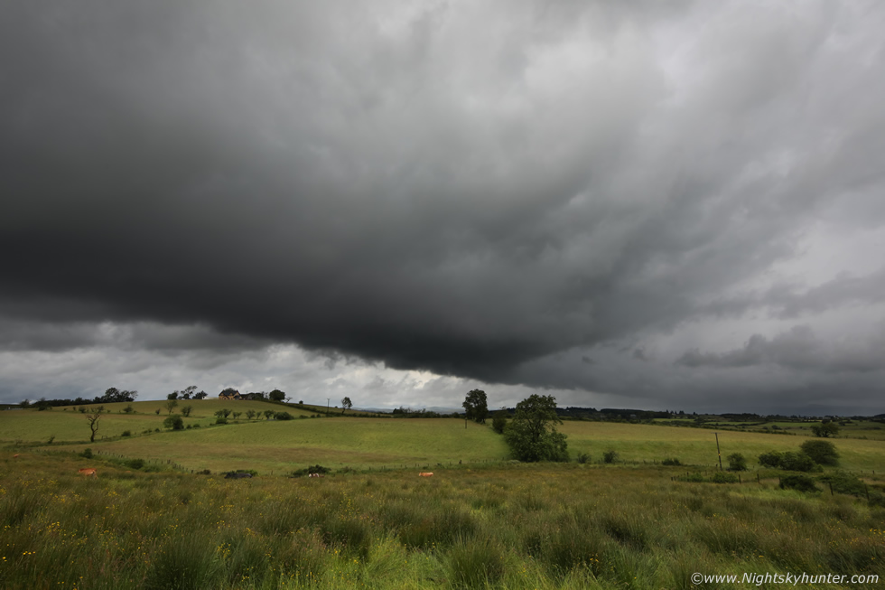
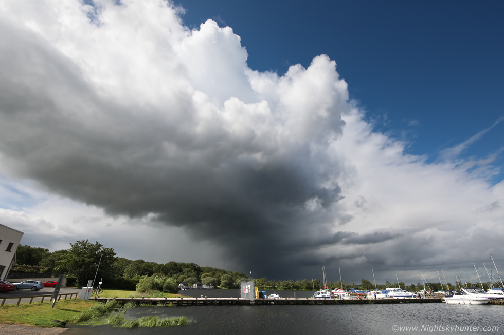
Despite a major let down I never like to give up, I was on the lap top at 06.30 then at 07.00 an interesting cell came off the W coast and matured over Co. Mayo taking on the classic sheared Eagle wing form and remained on radar for over two hours!, this was very encouraging, perhaps there was a real chance after all. I waited for cells to cross the border before making a move, I noticed a sheared cell passing over Co. Tyrone to the E of Omagh and below it perhaps 30 miles away was another, so these became my targets. I drove out the Cookstown-Omagh road and looking due W through breaks in the cloud I could see the Omagh cell, I had to admit I was impressed from the glimpses I was getting, the tops were massive, but capped, and leaning over with shear, the base was very long, dark and close to the ground. I pulled over at the road side, by the time I got out with the camera the cell had crossed from the W into the NW fast, the above image is the dark base with wispy scud rising up as it fed off the low level moisture, the area above the tree at centre was interesting with L to R and R to L motion at the same time suggestive of rotation or convergence, the precip was sheared far away to the R and forward into the distance.
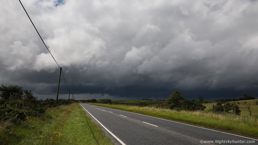 |
Just as I was getting into things the cell was gone, I waited at the side of the road knowing the other cell to its' S wouldn't be far away and within half an hour it came into view, this was the base passing to the W side of the Omagh road from L to R with the 15-30mm at 30mm on the full frame, again the base had plenty of dark scud rising, I was on full funnel/tornado alert, given the shear and low bases it was certainly possible.
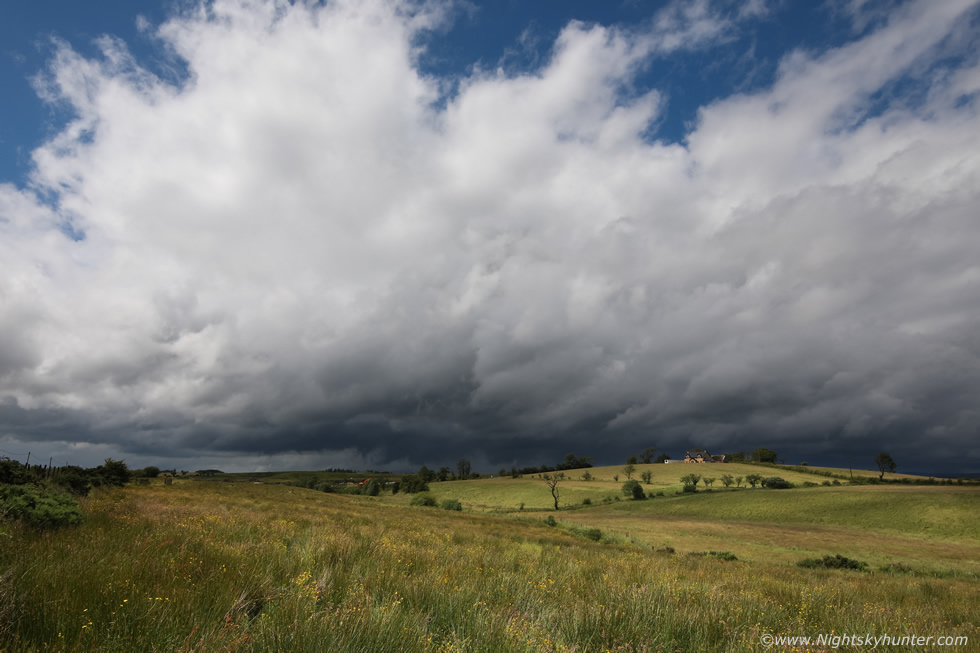 |
I couldn't even relax and watch the cell as it was flying past, a combination of 20mph at the surface and over 40mph at the mid levels just made this thing pass like a car cruising across the countryside. I ran across the road, jumped over a gate, and landed in this photogenic field, one of my favourite local storm watching spots in this area. The cell was already getting further away and fragments of cloud hid the towers and structure, I could only see the flank and base, I took an image anyway as the scene was quite contrasty, it was mostly overcast however pockets of sunshine would appear at random and light up the field for me. The wind was blowing the grass in patterns across the fields which was nice to watch and at least it was a warm wind.
 |
The cell was gone in no time, I waited around for another hour on new developments and saw nothing of interest, I knew those warm cloud tops and a capping inversion were really killing this day. Despite these complaints I was still having fun, I really am in my element out in nature on a muggy day watching storm clouds. It was already 13.00 and I knew my time was limited as the CAPE would shift into the E by late afternoon so there was no time to relax, every decision needed to be correct on a day like this. I recalled the models showing Lough Neagh as a possible target area, in fact, the AROME had showed several interesting cells in that area between 14.00 and 15.00, so I turned around and headed for the tornado alley of Mid-Ulster (the lough).
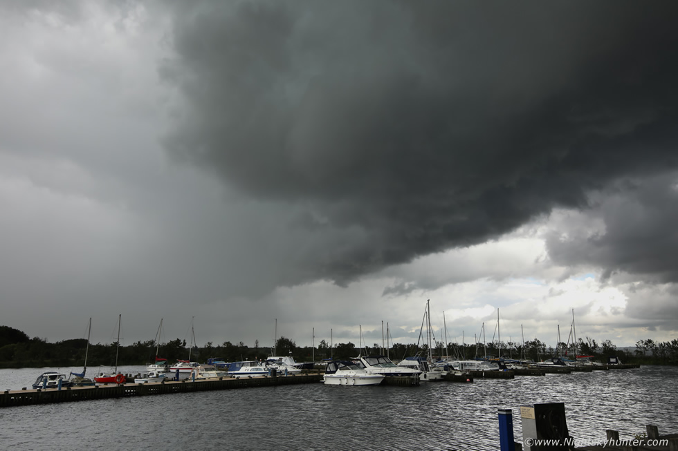 |
I arrived at Ballyronan Marina where I would spend the next several hours. I had a flask with me and snacks to pass the time and I took Rhua for a walk, it was windy, mild and fairly overcast, we didn't get the strong afternoon sunshine that was promised by the television forecast, any solar heating would have helped the synoptic situation but given this was a warm sector set-up the clouds were fully expected. A cell did move in later, quite of out nowhere with an unimpressive but beefy gust front, the lough itself was stirred up like the sea with white horses, again it was an Autumn scene and not Summer. This was the leading edge of the gust front passing with the wide angle as rain drops began to soak the area, some of these days there's going to be a big waterspout over this lough.
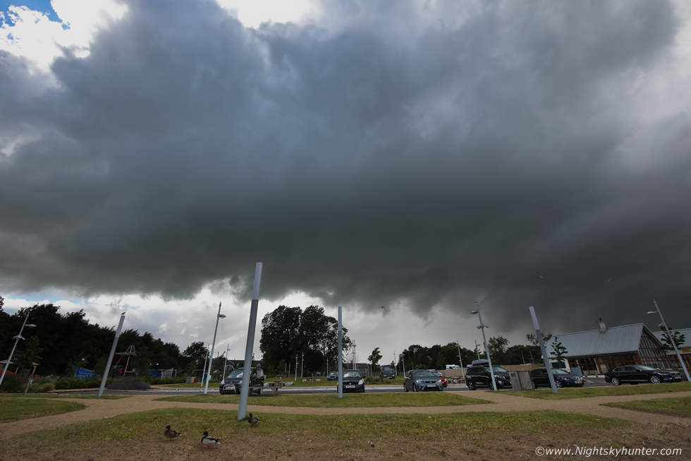 |
An hour later I was sitting in the van reading a book on Astronomy when I decided to step outside to stretch and looked behind the tree line of the marina car park and saw this coming in. This rapidly became interesting, this wasn't a gust front, it was the updraught base of a large cell brushing past the area, I observed that the base was bowing into a partially rounded shape and below it dark scud swirled and lifted into the base, this was actually trying, I ran out onto the small beach and took this wide angle image, I had no choice but to shoot from where I was as the cell was rite on me.
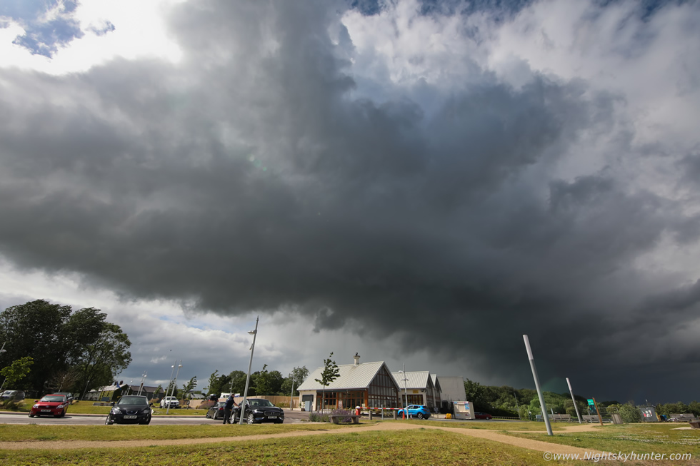 |
It was moving fast, panning to the right, the updraught base was now over the cafe and marina buildings. For those interested in lenses, the Tamron 15-30mm F/2.8 is amazing, however it doesn't like the sun on the glass, I will often get lens flares and coloured spots in these situations. Cell moving L to R.
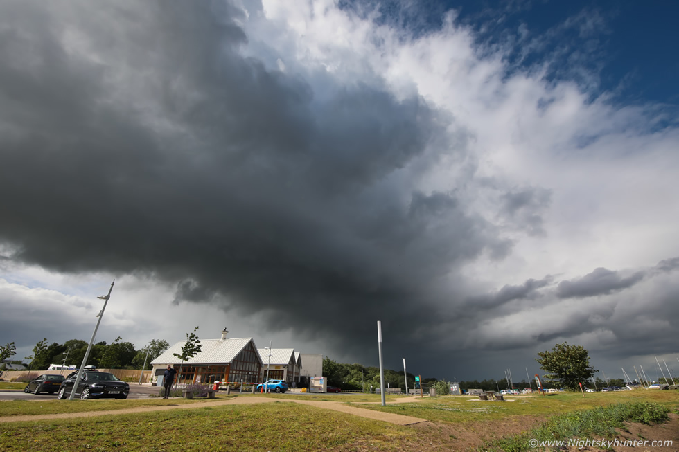 |
15mm wide angle, this was the most interesting thing I had seen all day, a curved base, rising inflow and what looked like low level inflow bands feeding in from the E. High above me I could see several towers aloft but couldn't get them in the frame, the precip was sheared downwind away to the N towards Maghera.
 |
As it moved away I could get several towers in the frame, they even look warm in this image, if only the tops had been -40c this day, this could have been a great storm. It was 16.30 and I decided I had had enough, the CAPE was waning and the bases were getting higher and there was nothing else to see so I began the drive back to Cookstown.
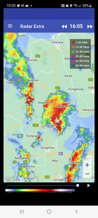 |
John Fagan rang me, he had just finished work, he asked where I was, I said I had just left Ballyronan Marina, he said there was a very interesting cell on radar in that area at 16.00 which had the sheared Eagle wing appearance, I thanked John for letting me know, that sure explained the structure I had seen which I had deemed 'interesting', John kindly took this screen grab for me. A few thunderstorms did break out below the border to the SE and near Co. Down then the afternoon turned quiet.
June 30th was another convective day but one which I knew was a bust the moment I looked at the models. Yet again, good shear, however CAPE was low end and cloud tops were too warm and capped yet again, yet television forecasts were going for thunder, I never saw any potential for sparks at all. The models showed best instability inland however I also wanted to get drone footage of a cruise ship which had just arrived on Lough Foyle, this was the largest passenger vessel on the Foyle this year at 206m in length called Seven Seas Voyager. Since the storm potential was so bleak I instead decided to focus my attention on the ship and hope that I might get convection while I was there.
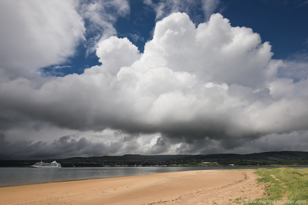 |
So I spent the day at Magilligan Point, my plan was to get the cruise ship then film her leaving which meant getting the ferry over to Greencastle however I had heard it would be 18.00 before she left so I had time to kill. The entire day was dry so at least it looked promising that I would get flying the drone, by mid afternoon some narrow pockets of sunshine broke through and convection began to rapidly form, this was actually a nice scene with sunlit towering cumulus bubbling up over Donegal, they got quite beefy, this image is 30mm on full frame, however they were capped as I expected and couldn't get higher, that being said I sat on the warm sand dunes with Rhua watching the base as rising scud teased me into thinking a funnel was possible.
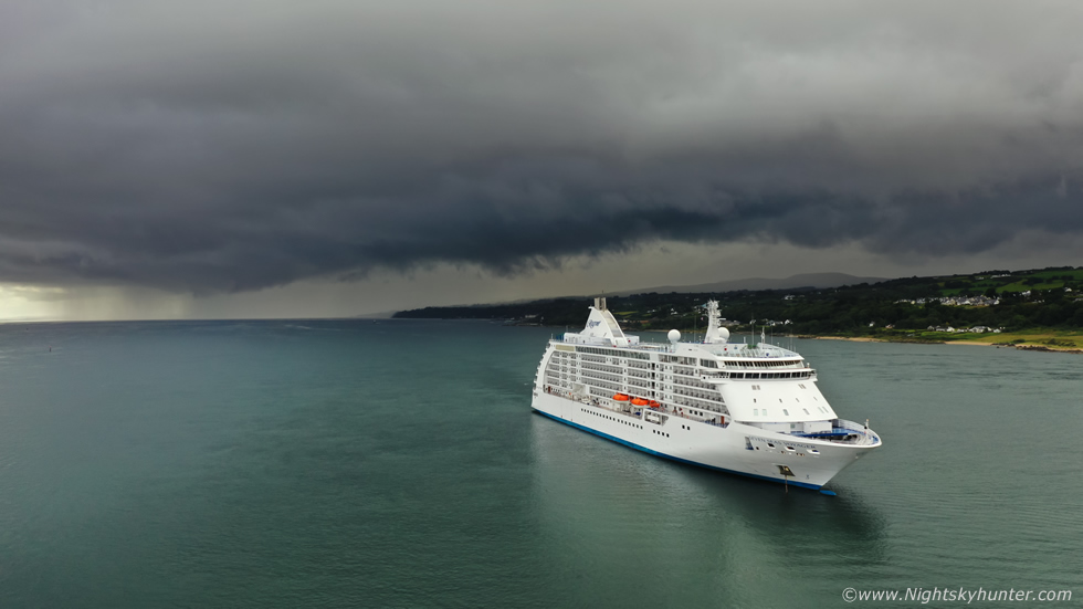 |
By early evening the ship was preparing to leave so I got the ferry over to Greencastle and got the drone ready, then a large cell formed over Donegal and began slowly creeping over the lough getting closer and closer to the ship, I knew I would never get footage of her leaving as the timing of the rain and ship departure looked perfect, typical I thought, Summer 2022 strikes again. So I quickly got in the air to get a few images of her for the record, however the cell began to get my attention and quickly became the focus of my aerial images. Visually the clouds were extremely dark with mean looking black scud sections hanging low down over the precip curtain, clear convergence could be seen with a sea breeze meeting the surface flow and it was this that was helping the cell build.
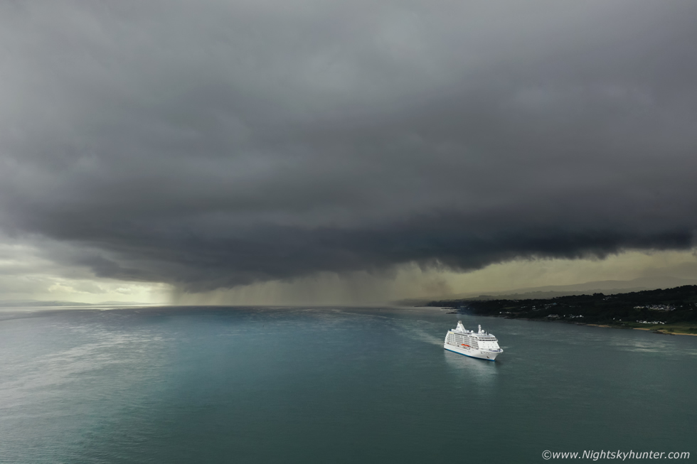 |
Quite a cool scene unfolded with the cell's dark gust front edging over the lough, and now I had a cruise ship as foreground, combine this with the striking green sea and it made for quite a dramatic moment.
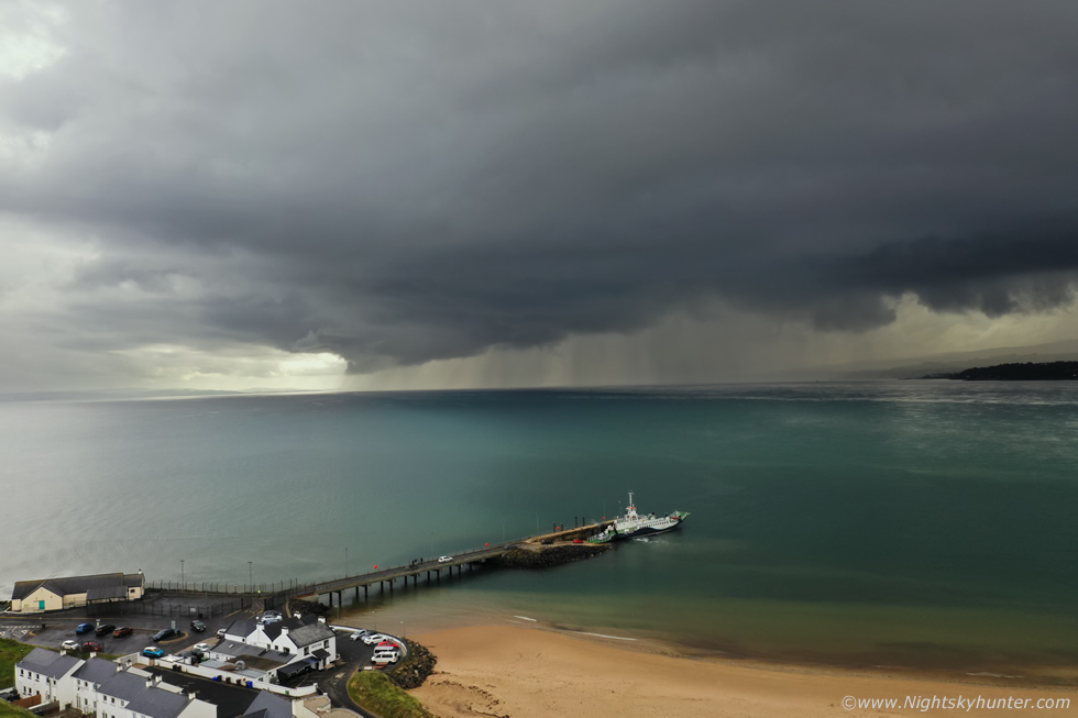 |
I got the ferry back to Magilligan Point and got the drone back up before the rain hit, I really liked this scene with the pier leading the eye into the storm, a classic example of how drones are a great tool for storm chasing, had I shot this from the beach with the DSLR it would have been less dramatic and I wouldn't have got this vibrant green colour to the water which could only be viewed from above. This moment actually justified the drive, had that cap not been in place this undoubtly would have been a thunderstorm.
 |
West side of the cell bowing out
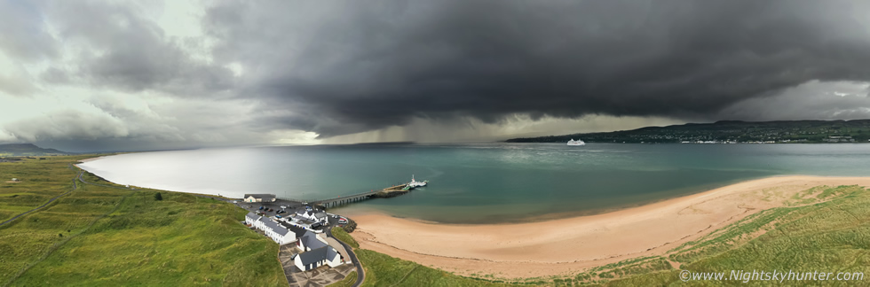 |
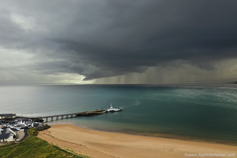
180 degree aerial pano showing the Point Bar, pier, ferry, houses for hire, cruise ship, storm clouds, Magilligan Point and even Binevenagh to the far left, keep in mind this is a huge area of sky. Then the cell hit, I took shelter behind Martello tower thinking it would soon pass, but I got absolutely drenched, soaked to the skin, in the middle of the heavy rain I heard the ship's horn sound across the lough then she sailed away to her next destination, I never had a chance of getting her. The drive home was a very wet experience with heavy persistent rain all the way from Magilligan to Coleraine, then Garvagh, I only managed to clear the core near Swatragh, at least the van got a wash.
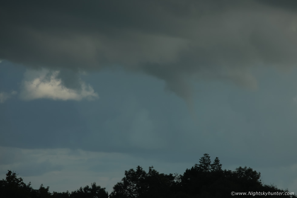 |
As I was driving S along the carriageway outside Cookstown heading for home the atmosphere was much better with sunny spells and isolated convection, I was tired and was just looking forward to getting in the house to relax after a three hour round trip when I glanced to the SE and immediately saw a funnel cloud. The funnel was well formed and quite obvious, I was surprised to see one to be honest as the tops of the cell it was hanging from had spread out into a flat layer of cloud under a capping inversion. Of course I was on the carriageway driving between road cones thanks to road works and by the time I got pulled over near the Dromona cream factory the funnel was already weakening, the time was 19.50 LT. I grabbed the 5D and 100-400mm lens and grabbed a few rapid fire images, the scene was now dark and of very low contrast.
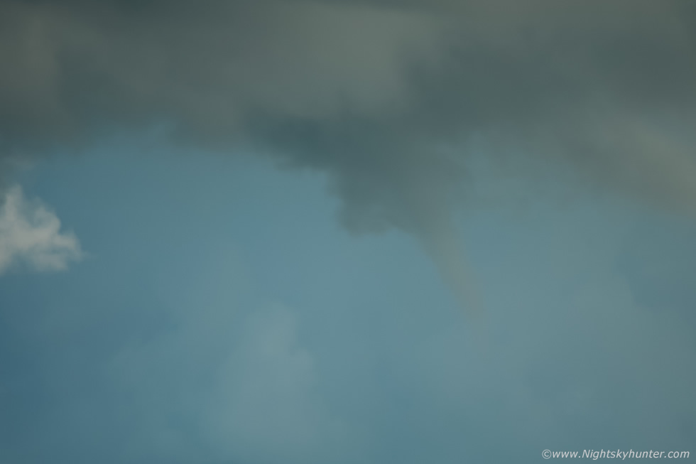 |
400mm and cropped, I actually had to contrast this 80% to make it stand out from the haze, however you can clearly see the condensation tube. After a few minutes it was gone and judging by its direction and distance I suspect it may have been rotating directly over my own neighborhood a couple of miles away! Despite not being a photogenic funnel this was something I didn't expect to see at all this day, I thought this had went down as the latest funnel I have ever captured, however Philip Blackstock informed me that this was my second latest funnel, the latest was during 2008, thanks Philip for reminding me of that one. Incidentally, this is the fourth funnel cloud I've witnessed this Summer.
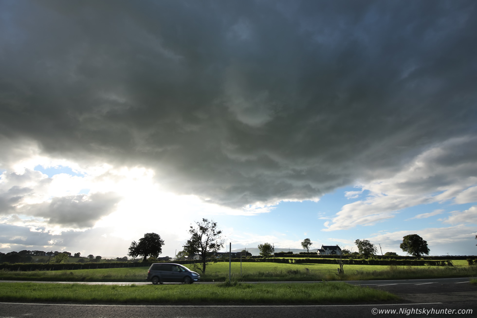 |
After the funnel vanished I turned to the W and saw this nice isolated updraught base sitting rite over the carriageway with fine textures along the base, it was also rounded, do you see the white lowering above centre? that was slowly rotating, I was hoping for a close range funnel to form directly above me but it never developed further than this. Excuse the blown out areas of the image, I was shooting into the sun, the sun itself was appearing from behind cloud and the base was back-lit so quite a high dynamic range scene.
This is all I have got during the month of June, early July is currently even worse so there are great concerns this Summer could be the worst on recorded for convection and warm weather and clear skies. We still have mid July, August and even early September, it's all up to nature now, despite great frustrations with the weather I firmly believe that nature will turn the tables soon and reveal something very special indeed. Until then, thanks very much for reading.
Martin McKenna
